Ross Island From Space
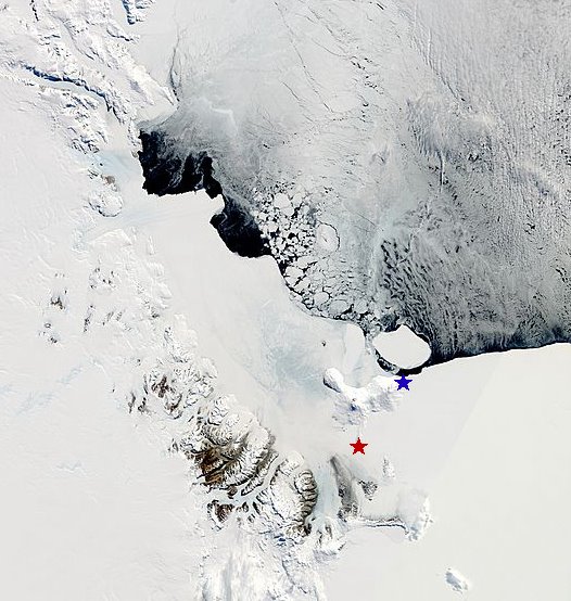
This is a recent image of Ross Island and vicinity taken from the MODIS Terra satellite. McMurdo station is the red star. It's on the SW tip of the island. Cape Crozier (one of our field sites and the location of the largest Adelie Penguin colony in the southern Ross Sea) is the blue star and is on the eastern tip of the island. The distance between the two stars is about 80 km. Surrounding Ross Island are sea ice to the E-NE, the Ross Ice Shelf to the E-SE, the Ross Sea to the north (filled with pack ice), and the darker brown Transantarctic Mountains to the SW, marking the coast of the continent proper. Black is open water, areas that are kept clear of sea ice by the persistent winds from the Antarctic ice cap.
Directly in front of Cape Crozier is iceberg B15-J, a remnant of what was once the larger B15. It's been rotating in place and occasionally smashing into the coastline in front of the colony since 2002, making life harder for penguins that are trying to access the colony and forage during the breeding seaosn.
posted by Viola @ 7:38 PM
0 comments
![]()
![]()

0 Comments:
Post a Comment
<< Home